
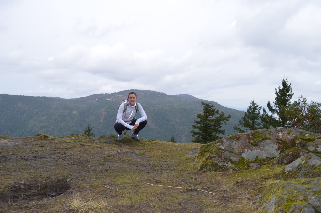
The view from the top of Jocelyn Hill
Highlight: Views of the Olympic Mountains, Finlayson Arm, Saanich Inlet and the Gulf Islands.
Distance: Jocelyn Hill (434m) Loop from McKenzie Bight parking Lot is approx. 12km total (I am estimating – no fancy GPS at the moment).
Difficulty: Moderate. Steep stretches, lots of up and down. Cumulative elevation gain: 620m.
Directions: Follow Pat Bat Hwy (#17) from Victoria; exit at West Saanich Rd. Follow West Saanich Rd, take a left at Wallace Drive. Left again on Willis Point Rd. Left onto Ross-Durance Rd, parking lot is on the left. From the parking lot, walk to the road, turn left and follow the sign for Timberman Trail. Trail will start on the right (west) side of the road.
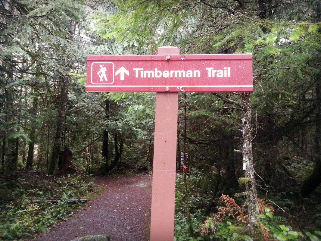
This is the sign you are looking for.
Notes & Links:
- Google map to the parking lot
- Trail map
- You can do a straight out and back, or loop using the Lower Jocelyn Hill trail (recommended), it is well-signed but make sure you are reading the trail signs and maps carefully, it is a bit confusing
- Jocelyn Hill can also be approached from the Caleb Pike Trail Head via Holmes Peak
I have found that when I set out for a hike in Victoria up a “mountain,” it is quite a different experience from hiking a MOUNTAIN in Vancouver. I would say we probably max out around the 450m range over here. Or at least that is my experience to date. This usually means you can be up and down within a couple of hours. Jocelyn Hill was a nice change – it took me probably two hours just to reach the summit and if I had brought more food with me, I probably would have continued on to Holmes Peak.

A fork in the road – go left
Actually, I lie – it wasn’t just my hunger pleading with me to turn back, but my active imagination. My mind was playing tricks on me. It was so dark and quiet – all I could think about were all the evil creatures lurking in the shadows. You know how in fairy tale movies, there is always a part of the forest where everything is really dark and the main character who is somehow forced into the forest has to battle witches and wolves and mushrooms that try to poison you and trees that try to capture you, just to name a few…. yes, felt a bit like that.
It also did not help that fresh in my mind was the alert I read that morning warning of cougars in the area – apparently a dog had got into an “incident” at the Caleb Pike Trail Head.

The forest looking particularly dark
But then! Perched upon a fallen log was a friendly squirrel, or at least I assume he was friendly – they all are, aren’t they? Anyways he brought me back to reality… the forest is filled with lovely creatures, especially when you start to sing – then the sun suddenly comes out and the birds flit about and land on your shoulder. Well … maybe not quite back to reality yet.
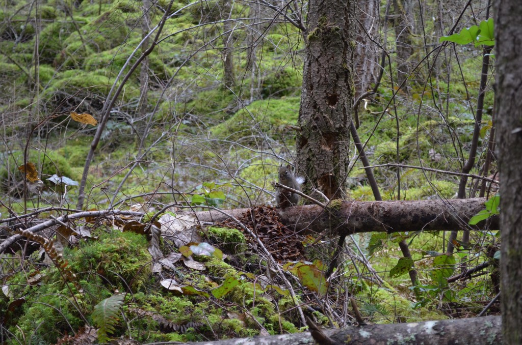
My friendly squirrel
Squally Reach Viewpoint
The view from Squally Reach is definitely worth the slight detour. I hear you should also go check out the Malahat Viewpoint, but there are no signs for this, so make sure you check it out on the map – a tip perhaps – instead of carrying a guidebook or map with me, I just take a picture of one on my phone!
More details check out Gowlland Tod Park website.
Categories: British Columbia, Hiking, Vancouver Island, Vancouver Island, Victoria
 Mt. Finlayson
  Mount Douglas
  Mount Work
Leave a comment